Sunset in PV

Sunset in PV

Saturday, June 30, 2012

June 24 – 30, 2012 "Portland, OR and Mt. St. Helens"


My hopes that the weather would be nicer / drier in Portland were quickly diminished on arrival with two more days of rain. We decided that we NEEDED to get out of our quickly shrinking 450 square feet when CC started pacing; that’s my gig and mine alone. She called our new friends, Pat and Joyce, parked next to us, that we met in Crooked River, and the girls came up with an indoor excursion to the Columbia Gorge Interpretive Center Museum. As you can see from the picture, it’s wet; typical weather in the Northwest. I probably shouldn’t be whining, as temps across the Midwest have been in triple digits, while we have been in the 60’s and 70’s. (Click on any image to enlarge.)

After paying our entrance admission, we spent the next two hours discovering who had settled the gorge, their impact, and their dependence on the natural resources in and around it; mainly logging and salmon fishing. Other exhibits were personal possessions from early settlers, including this rare 1919 Cunningham.


Fish wheels were water-powered nets that automatically scooped up migrating salmon and steelhead that were funneled into the "wheel". After netting, the fish were dropped into a holding bin. This method was very productive, but nearly abolished the Columbia River of salmon in the late 1800’s, as very little was known at that time of their reproductive habits; the practice was later outlawed, and salmon once again began to flourish.


Logging was, and still is, the predominant industry in the Northwest. An early “chain driven” logging truck used to transport timber to the mill. 

As we exited the museum, noticed the rain had subsided, and decided to explore Beacon Rock, the core of an extinct volcano, located on the north shore of the Columbia River in Washington.


The placard at the base claimed there were 52 switchbacks, and some 15% grades on the ascent to the summit 900 vertical feet above. On the way down, CC counted each and every one……..yep, 52.


Henry Biddle bought Beacon Rock for the phenomenal price of $1, shortly before he began building the trail up the sheer rock face to the top.

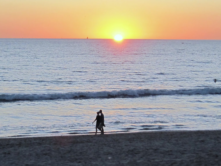
Almost an hour later and a 9/10 mile hike, we arrived at the summit. What a view of the Columbia River Gorge!


Pat and Joyce weren’t even winded from the hike. I think he is part mountain goat the way he scrambled up the trail.


What a day! We returned home, and had happy hour with Pat and Joyce. As the temperature cooled to the 60’s around 8:30 pm, we all decided tomorrow is another day, and retreated to our rigs for some much needed nourishment.
The following day after watching the weather, which was predicted to be cloudy with a slight chance of rain, the girls decided on Pioneer Square, Powell Books, and the International Rose Garden ….(Oh whoopee!) We arrived downtown Portland and drove around for at least 15 minutes looking for a parking spot, and finally found the Hilton parking garage open. OK, off to Pioneer Square where we found this directional post, indicating we were indeed in Portland.


The downtown area has many, many (hundreds) of sculptures in a variety of mediums. We could have taken a few days to explore them alone, but thought a couple unusual ones would be apropos, as time was of the essence.


This kinetic art was created from stainless steel, aluminum, titanium, and bronze. Can you identify what parts are which? The center pendulum, with a little LOT of persuasion, actually moves and is adjacent to a Portland landmark; Powell Books.


This store is huge! It’s a Barnes and Noble on steroids with every book imaginable on the shelves. It was very busy with all ages and socio-economic backgrounds, (Politically correct term for homeless), as well as “Sheldon” wannabees.


We walked a few blocks to Chinatown, and couldn’t help myself when I saw this sign; sometimes the original meaning is lost in the translation. But then again, maybe not; what an egotist!


As noon approached we decided to walk the 8 blocks to Paddy’s for lunch, and a bit’o libation. Me? Balvenie Doublewood 12 with a Sherry finish. And Pat? Top shelf all the way; Glenlivit 18. I think we’re going to need this before our next stop at the Rose Garden.


By the time we arrived, it was late in the afternoon, and finding a parking space was akin to finding a needle in a haystack. But, perseverance and intestinal fortitude prevailed, and finally CC and Joyce were in rose heaven. As for Pat and me; thank you Paddy’s.


I will admit the gardens were well taken care of, and cover 4 ½ acres with only one full time employee, and the assistance of over 80 volunteers.


Of the hundreds of rose pictures taken, CC chose this one as her fav. Me? I thought they all looked like roses; from very small to very large.


Back at the rigs, exhausted, we once again celebrated happy hour and planned activities for tomorrow. It looks like the weather is finally going to break, and be sunny for a change. This means our postponed week long plans to visit Mt. St. Helens may become a reality. After watching the 10 o’clock news and weather, it’s confirmed; we will depart manana at 9 am for the 100 mile drive to the Mt.

Our first stop was at the visitor’s center, approximately 17 miles for Mt. St. Helens. In the valley, pictured below, where the river runs, was a giant mud flow after the eruption, raising the valley floor some 30 – 40 feet.


The view below is from Johnston Ridge, just 6 miles from the original “peak”. In the lower left corner is the top of the original mountain, after the eruption.


At 8:32 Sunday morning, May 18, 1980, Mount St. Helens erupted, shaken by an earthquake measuring 5.1 on the Richter scale, the north face of this tall symmetrical mountain collapsed in a massive rock debris avalanche. In a few moments this slab of rock and ice slammed into Spirit Lake, crossed a ridge 1,300 feet high, and roared 14 miles down the Toutle River.

The avalanche rapidly released pressurized gases within the volcano. A tremendous lateral explosion ripped through the avalanche and developed into a turbulent, stone-filled wind that swept over ridges and toppled trees. Nearly 150 square miles of forest was blown over or left dead and standing.

At the same time a mushroom-shaped column of ash rose thousands of feet skyward and drifted downwind, turning day into night as dark, gray ash fell over eastern Washington and beyond. Wet, cement-like slurries of rock and mud scoured all sides of the volcano. Searing flows of pumice poured from the crater. The eruption lasted 9 hours, but Mount St. Helens and the surrounding landscape were dramatically changed within moments.

A vast, gray landscape lay where once the forested slopes of Mount St. Helens grew. In 1982 the President and Congress created the 110,000-acre National Volcanic Monument for research, recreation, and education. Inside the Monument, the environment is left to respond naturally to the disturbance.


Standing on the ridge, it’s hard to imagine the energy needed to move this much mass, and pictures do not paint the complete picture. Scientists, engineers, and mathematicians have calculated that Mt. St. Helens erupted with a force equal to 500 atomic bombs, similar to the ONE dropped over Hiroshima, Japan, ending WWII.


Well folks, there you have it; our week in and around the Portland area. We had a great time, and enjoyed it even more so with our new friends Pat and Joyce. They are headed to Calgary, and then to Cheyenne for the rodeos. We, on the other hand, will move northward to Centralia, WA, and spend the week of the 4th in Hoodsport, WA. Until our paths cross once again, hasta luego mi amigos!

Thanks for stopping by; until next time, take care and stay well………….

Tuesday, June 26, 2012

June 17 – 23, 2012 “Mt. Hood and Columbia River”


The 100 mile trip northwest from Crooked River to Welches was very windy, and contrary to what some believe about tag axles, we were pushed around quite easily on the two lane highway 26 by the broadside 35 – 45 mph gusts; granted, not as bad as the Suncruiser, but bad enough to be very diligent while driving the winding road. We arrived at Mt. Hood Village RV Resort about 2 pm, and were assigned site 41. (Click on any image to enlarge)


As you can see from the picture above, it is very green around the base of Mt. Hood for one reason; rain and / or snow, which we had for the next two days, almost non-stop. It gave us some time to do the necessary housecleaning, laundry and catching up on e-mails. Lucky for us, by the third morning, the sun gods decided to smile upon us, and our cabin fever was broken; off for the short 15 mile drive to Mt. Hood.


TimberlineLodge at Mt. Hood is a mountain lodge on the south side of Mount Hood in Oregon, about 60 miles (97 km) east of Portland. Built in the late 1930s, this National Historic Landmark sits at an elevation of 5,960 feet within the Mt. Hood National Forest and is accessible through the Mt. Hood Scenic Byway. It is a popular tourist attraction, drawing more than a million visitors annually. It is noted in film for serving as the exterior of the Overlook Hotel in The Shining.

The lodge was constructed in 15 months between 1936 and 1938 as a Works Progress Administration (WPA) project during the Great Depression. Workers used large timbers and local stone, and placed intricately carved decorative elements throughout the building. President Franklin D. Roosevelt dedicated the Lodge on September 28, 1937.


We continued on Hwy 26 as it loops around Mt. Hood, as it connects with Hwy 35 for the trip northward through the fruitful valley to Hood River. There we picked up I-84 westbound for the short drive to the dam.

Bonneville Lock and Dam consist of several run-of-the-river dam structures that together complete a span of the Columbia River between the U.S. states of Oregon and Washington at River Mile 146.1. The dam is located 40 miles east of Portland, Oregon, in the Columbia River Gorge. The primary functions of Bonneville Lock and Dam are electrical power generation and river navigation. The dam was built and is managed by the United States Army Corps of Engineers. Electrical power generated at Bonneville is distributed by the Bonneville Power Administration. Bonneville Lock and Dam is named for Army Capt. Benjamin Bonneville, an early explorer credited with charting much of the Oregon Trail. The Bonneville Dam Historic District was designated a National Historic Landmark District in 1987.


Despite its world record size in 1938, the original Bonneville Lock became the smallest of seven locks built at different locations upstream on the Columbia and Snake Rivers; eventually a new lock was needed at Bonneville. This new structure was built on the Oregon shore, opening to ship and barge traffic in 1993. It is large enough to handle a tug with five barges, with a 60 foot ascent or descent, depending on direction of travel.


Take the time to view the 3 part video on Bonneville Lock and dam on You Tube Video below.


Back in the car, and after a short drive we arrived at a waterfall as magnificent and memorable as any in the country. Visiting Multnomah Falls, a 611-foot-tall roaring, awe-inspiring cascade of icy water, lets you experience the power and beauty of nature up close and with ease. From the parking area off of I-84, a 5-minute walk is all that separates you from the exhilarating spray at the base of the falls.


WOW……….all that in one LONG day. We were totally exhausted, and couldn’t wait to get back “home” for happy hour around 7 pm; a little lot later than usual. By the time we ate and showered it was time for the sandman to arrive. Tomorrow is another day.

OK, I consider myself a patient person; usually. But two more days of rain? Moss is starting to grow where the sun doesn’t shine, and that is NOT a good thing, because it’s on me! Oh well, Mother Nature wins again. From here we will move to Portland, and hopefully some drier weather, down in the valley.

Thanks for stopping by, until next time, take care and stay well…………….

Monday, June 18, 2012

June 8 - 16, 2012 "Central Oregon"


The trip from Prospect was uneventful, which is the way we like it. We arrived at River Rim RV Park in Crooked River Ranch, OR, 9 miles NW of Redmond around 2 pm and checked in with the owner Renee. This park only had 3 reviews and we were not sure, so we only booked two nights at the Passport America rate of $16.50 per night. After we were set up, and had a chance to relax watching the Golden Eagles soaring above, decided this park and the surrounding area would be worth exploring, so we extended for an additional week at $20 per day.


Newberry National Volcanic Monument is located south of Bend, Oregon, within the boundaries of Deschutes National Forest. In a region rich with interesting geology, the landscape found within the Volcanic Monument stands out. Lava flows, cinder cones, a cave, and an obsidian field combine with the typical Northwest lakes, rivers, forests, and mountains to form a unique and amazing landscape of rock and greenery. (As usual, click on any image to enlarge.)


Just a short drive north from the Lava Lands Visitor Center parking lot is Lava Butte, a nearby cinder cone. At the top are incredible 360-degree views that include the lava flows as well as Mount Bachelor, nearby Cascade Mountain peaks, as well as several other cinder and pumice cones scattered across the land. A short trail circles the crater rim, passing by Lava Butte's working fire lookout tower. 


When we arrived at the park, the gate attendant asked us if we would like to drive up to the butte, and naturally we said yes. She then gave us a pass, and explained they only give 10 per hour, as there were only 10 parking spots at the top. Our pass allowed us to depart at 11:15, and return at 11:45.


Peter Ogden was a Canadian who worked as fur trader and explorer for the Northwest Company and later for the Hudson Bay Company, and explored Oregon starting in the 1820's and discovered the Crooked River area.

Adjacent to the parking lot is this sign, which I have never seen before, especially the lower one. But after the short walk to the canyon, it became apparent.


There are 3 bridges at the viewpoint. The first, built in 1911 was, and is, a railroad trestle bridge over the Crooked River Canyon. In 1926, the second emerged as the only car bridge across the canyon until 2000 when the new bridge, called the Rex Barber Memorial Bridge, opened. Today the 1926 bridge is a pedestrian bridge over the Crooked River from which you can see the canyon and the old and new bridges on each side. As you look at the canyon below, know that "back in the day" when the first bridge was built, workers camped in the canyon and climbed up a 350 foot rope ladder to get to work each day.


A grisly historical footnote, the Ogden viewpoint was where two women from Oakland, CA threw two small children over the canyon wall, most likely from the railroad bridge, to their deaths in 1961. The mother, Gertrude Nunez, received a life sentence, but was paroled after 10 years of incarceration. The other, Jeannace Freeman, (Nunez’s lover), was convicted and sentenced to death, but when Oregon abolished the death penalty, the governor commuted her sentence to time served, and was released.


Famous throughout the country, Petersen's Rock Gardens is a testament to dedication and the fruits of one man's labors. As scenic attractions go, the Rock Gardens is small, nestled away in Redmond, a small town in central Oregon. Petersen's Rock Gardens is the creation of a Danish immigrant Ramus Petersen, who came to America in 1900 at the age of 17.


Over the years, he collected all kinds of colorful local rocks from an 85-mile radius of his home. These colorful rocks included Oregon agates, obsidian, petrified wood, malachite, and jasper. Ramus started building with them in 1935. At first, it was just a small rockery near his home. But he kept on building and building on his 4-acre site, until his death in 1952. He mortared the rocks together into miniature buildings, monuments, lagoons, and bridges, surrounded by lush gardens with lily ponds and little streams.


Rasmus built his folk art constructions of rocks and glass reminiscent of his native Denmark. But he also honored his new home with a tribute to democracy by constructing a concrete American flag and a replica of the Statue of Liberty carved by a local sculptor from a large boulder and the statue is even holding a light bulb torch. In front of the Statue rests a bronze plaque which Peterson had emblazoned "Enjoy yourself: it's later than you think." 


Steelhead Falls is on the Deschutes River, adjacent to Crooked River Ranch. It has an 18-foot, big river drop, in a sage and juniper canyon. It’s a moderate half-mile hike to the falls, with a few steep and narrow spots along the trail.


As we arrived, CC noticed two young men, about 18 or 19, standing above the falls. (Not surprising, being the cougar that she is.) By the time I retrieved the camera, only one was left standing. A few seconds later, he joined his buddy, plunging into the ice cold 35 degree water. (Click to enlarge image in red circle.) When the two emerged from their “swim”, I asked if the water was cold. They both replied, “Only the first time. Are you going to jump? It’s so much fun!” My reply, “I was only your age ONCE; for a reason”.


The Three Sisters (pictured below) are three volcanic peaks of the Cascade Volcanic Arc and the Cascade Range in Oregon, each of which exceeds 10,000 ft (3,048 m) in elevation.  They are the third, fourth, and fifth highest peaks in the state of Oregon and are located in the Three Sisters Wilderness, about 15 mi (24 km) southwest from the nearest town of Sisters, Oregon.  The three peaks have 15 named glaciers among them, nearly half of all the 35 named glaciers in Oregon.  The Sisters were named Faith, Hope, and Charity by early settlers, but these names have not prevailed. 


Finding a BBQ joint in Sisters was a surprise; but finding a really good one was a miracle. The pulled pork at Slick’s Que Company was smoky, juicy, and perfectly seasoned, as was the brisket. And those burnt ends…………..ahhhhhh…………to die for!


Once a lumber producing town, Sisters is now known as the Gateway to the Cascades. The downtown area has been transformed, and today Sisters is recognized as a unique place to shop with its many specialty stores and galleries. Below, CC tries out a pine rocking chair next to a juniper floor lamp; no two are alike.


Lake Billy Chinook has existed since 1964 when Portland General Electric constructed the Round Butte Dam. The lake was named for Billy Chinook, a well-known Wasco Indian scout from the Warm Springs region who traveled with explorer John Fremont in 1843. Surrounded by mostly public lands, the lake includes 72 miles of shoreline and a surface area of 4,000 acres. Its deepest point is 400 feet at Round Butte Dam.


About 10 - 12 million years ago, alternating layers of stream sediments, volcanic debris and basaltic lava flowed from the Cascade Mountain Range into a huge basin in this area. Named the “Deschutes Formation,” these exposed layers of material were capped by lava flows from Cascade volcanoes three million years ago. Known as “rimrock basalt,” the cap is easily seen high atop the steep cliffs of the canyons. Subsequent periods of dramatic water erosion and volcanic activity have formed the awe-inspiring canyons and vertical cliffs seen today.


The Humane Society of Redmond sponsored an open house alpaca shearing at the Crescent Moon Ranch; admission was free and donations were appreciated. CC and I were both very, very impressed with how perfectly manicured and well maintained the Crescent Moon was.


Alpacas are raised specifically for their fiber; unlike their cousins the llama, which are used as pack animals, as well as for their fiber. Below, a baby alpaca chases after his mother, on the lush grassy pasture where the young are kept.


We missed witnessing the birth of this newborn by 15 minutes. The female to the left of the newborn is due as well, and as we were standing there, the owner came and raised her tail to check on progress, and commented, “anytime now”.


Yearlings are restrained, for their protection and the ones doing the shearing. After their first haircut, restraints may or may not be needed, as some seem to enjoy losing their coats as warm weather arrives.


As the alpacas looked on with curiosity, the 75 – 100 owners of classic and custom cars were busy polishing and spit shinning their “rides”. We have been to a few car shows / rallies, but the overall attention to detail was as fine as we have seen.


This is their “hobby”, and they love talking about their car; what they have done, and how, and what they plan on doing next. There was a common theme amongst the owners; the work is never complete, no matter what. There is ALWAYS something bigger, better and badder on the drawing board, just as soon as finances will allow.


This ’69 Camaro was absolutely perfect; better than when it rolled of the showroom floor. It was my dream car in high school, (oops, showing my age) but a base price of $3,000 kept my dream from becoming a reality. Don’t ya just hate it when that happens?


That’s it folks. It doesn’t feel like we’re that busy, but writing about it sounds like work; and I must admit, it is. This lifestyle is not for the weak or faint of heart. We fully accept responsibility of the burden that has been placed upon us, and enthusiastically look forward to tomorrow.

From here, we will be moving just west of Mt. Hood for a few days. There is still snow, so who knows, we may even try a little schussing. Thanks for stopping by. Take care and stay well my friends………………….